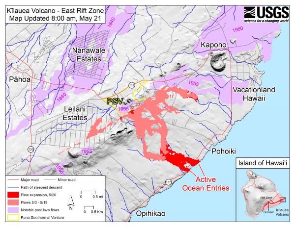
We have been watching Kilauea for a long time now. From Wikipedia:
The current Kilauea eruption began on January 3, 1983, along the eastern rift zone. The vent produced vigorous lava fountains that quickly built up into the Pu’u ‘O’o cone, sending lava flows down the volcano’s slope. In 1986, activity shifted down the rift to a new vent, named Kupa’ianaha, where it took on a more effusive character. Kupa’ianaha built up a low, broad volcanic shield, and lava tubes fed flows extending 11 to 12 km (about 7 mi) to the sea. Between 1986 and 1991, the connection between Chain of Craters Road and Hawaii Route 130 was cut, and the community of Kapa’ahu, the village of Kalapana, and the subdivisions of Kalapana Gardens and Royal Gardens were lost to the lava.
My family originally planned to purchase a lot in Royal Gardens, but we managed to get a quitclaim on the property and didn’t lose anything but a dream of a retirement cabin there.
If you’re interested in daily status reports, the US Geological Survey produces them. It also posts photos and videos of each day’s events.

Click here for a larger version of that map, with areas in purple designating previous lava flows from 1840, 1955, 1960, and 2014-2015.